
Part of the The Trans-Alaska Pipeline System (TAPS)
Originally uploaded by Leone Fabre.
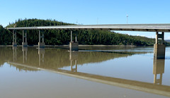
July 7 2008 - took a tour to the Arctic Circle, a trip of some 185 Klm (115 miles) north.
On the way we saw the amazing Trans-Alaska Pipeline ..... an awesome structure. I really was impressed by all the work that went into the construction of it.
...... and from Wikipedia:
The Trans-Alaska Pipeline System (TAPS), usually called the Alyeska Pipeline in Alaska or the Alaska Pipeline elsewhere, is a major U.S. oil pipeline connecting oil fields in northern Alaska to a sea port where the oil can be shipped to the Lower 48 states for refining.
The main Trans-Alaska Pipeline runs north to south, almost 800 miles (1,300 km), from the Arctic Ocean at Prudhoe Bay, Alaska to the Gulf of Alaska at Valdez, Alaska, passing near several Alaskan towns, including Wiseman, Bettles, Livengood, Fox, Fairbanks, and Glennallen.
Construction of the pipeline presented significant challenges due to the remoteness of the terrain and the harshness of the environment it had to pass through. Between Arctic Alaska and Valdez, there were three mountain ranges, active fault lines, miles of unstable, boggy ground underlain with frost, and migration paths of caribou and moose. Geological activity has damaged the pipeline on several occasions.
Since its completion in 1977, the pipeline has transported over 15 billion barrels (2.4 Tl) of oil.
But this is just one of the photos taken of this awesome project!!
more in next post!!!
No comments:
Post a Comment